Language

email feed

Warum VeloMap die beste RadKarte ist!

  • Hoher Kontrast Kartendesign optimiert fuer die kleinen Displays (1.8”-4”) von Outdoor GPS. Eigenes Layout mit wenig Kontrast für Planung am PC/Desktop.
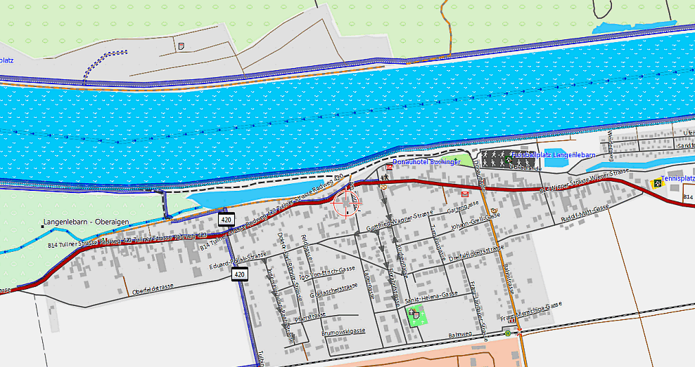
  • Straßentypen – Klar unterschiedene Farben je nach Wegart/Straße. Brücken und Tunnel hervorgehoben. Radwege und Radspuren detailliert dargestellt. Pfeile fuer Einbahnstraßen… Mehr dazu in der Kartenlegende.

  • Fahrradrelevante Informationen hervorgehoben und suchbar. Etwa Trinkwasserbrunnen, City Bike Stationen oder Fahrradshops.

  • Fahrradrouten nicht nur nach Wichtigkeit unterschiedlich NEBEN der Straße dargestellt, sondern wie auch alle anderen Dargestellten Informationen fuers Autorouting beruecksichtigt. Andere Karten zeigen zwar Fahrradrouten, lassen dafuer aber die Straße weg.

  • Navigation und Tourenplanung – Hoch ausgetüfteltes Autorouting optimiert fuer Radfahrer (Tour/Trekking) und Rennradfahrer.

  • Einfache Installation in Garmin Mapsource, Garmin Basecamp oder Qlandkarte GT um am PC Routen zu planen (dies geht durch das Autorouting auch fuer Wochentouren sehr schnell).

  • Ausfuehrliche Dokumentation – alles Wissenswerte zur Benutzung der Karten findet sich auf www.velomap.org

  • Höhenkonturlinien basierend auf viewfinderpanoramas.org Daten – integriert bei fast allen Ländern. Deutlich höhere Qualität wie die normal benutzten „void filled SRTM3" Daten.

  • "Weiße Karte" oder fehlender Fahrradweg? Jeder kann teilnehmen und die fehlenden Daten in Openstreetmap hinzufuegen. Zum wöchentlichen Kartenupdate werden immer die neuesten Daten aus Openstreetmap berücksichtigt. So werden die Karten Woche für Woche besser und kompletter. Wird eine in Openstreetmap berücksichtigte Information die für Fahrradfahrer wichtig nicht dargestellt? Einfach Kommentar schreiben und ich werde es wenn möglich einbauen.


Das erste mal hier, oder gerade erste Erfahrungen mit dem GPS gemacht?

Hier gibt es eine Übersicht wie man loslegt – Anfängerguide


Karten-Layout

Die Karten sind optimiert auf die kleinen Displays der OutdoorGPS und daher sehr Kontrastreich. Schließlich will man auch bei Licht/Schattenwechsel nich nur sicher erkennen können wo es langgeht, sondern auch wie der Wegzustand ist, oder um was für eine Straße es sich handelt. Da am Desktop die kontrastreiche Darstellung suboptimal ist, gibt es ein eigenes Layout zum planen am PC (mit Basecamp, Mapsource oder Qlandkarte GT). Genauer sieht man das an der Kartenlegende


Navigation

Garmin unterstützt in allen Programmen und GPS zwei Autoroutingmodi. Schnellere Zeit und Kürzere Strecke. In Verwendung mit den Velomaps, ist kürzere Strecke auch wirklich kurz (im Vergleich zu allen anderen Karten die ich ausprobiert habe), obwohl dabei versucht wird nur auf Nebenstraßen und Fahrradwegen zu routen. Mit dem Modi Schnellere Zeit, wird dagegen nach dem Motto "schönste / attraktivste" Strecke geroutet.

Da man mit dem Fahrrad deutlich häufiger abbiegt als mit einem Auto, dauert die Berechnung der Route etwas länger als mit Karten für PKW. Am PC mit  Mapsource 6.16 oder Basecamp v3 funktioniert Routing ohne Viapunkte bis zu 400km.  200-300km sind immerhin auf Nuvi/Oregon/Dakota/new Generation etrex/GPSmaps möglich. Und bis zu 100km auf alten GPS wie Legend/Vista HCx obwohl primär Nebenstraßen, Fahrradwege und Fahrradrouten bevorzugt werden (etwa 30-40km wenn eine Großstadt im Weg liegt). Somit kann man mit allen modernen GPS eine Tagesroute ohne Viapunkt berechnen, auf einem Vista HCx, sollte man mit 2-3 Viapunkten auch Tagestouren am GPS selber planen können. 


Was macht Openstreetmap und damit die VeloMap besonders?

Herkömmliche topographische Karten basieren auf den Daten der Landesvermessungsämter. Deren Daten sind oft schon vor Jahrzehnten aufgenommen worden. Sie sind fuer GPS Geräte in der Lagegenauigkeit ungenügend, und vor allem fokussieren sie hautpsächlich Wanderer. Zum Rennradfahren oder Fahrradfahren fehlen aber die relevanten Informationen, damit man weiß, ob man einen Weg fahren kann oder nicht.  In Openstreetmap dagegen werden solche Daten eingetragen. Die Karten zeigen daher zusätzliche Weginformationen, wie Fahrradspuren und Fahrradwege neben Straßen , Einbahnstraßenpfeile, Fahrradrouten, Wegzustand,…..

Jeder kann Mitmachen und die Karten vebessern!:

Wenn Wege oder sonstige Daten in den Karten fehlen, dann surfe zu www.openstreetmap.org und ergänze die fehlenden Informationen, Straßen, Wege, Gleise, POI…. auf der Tagging Anleitung gibt es eine Übersicht wie man die Fahrradrelevanten Informationen in "OSM einträgt"


Für wen sind diese Karten gedacht?

Primär Fahrradfahrer und Rennradfahrer, die übersichtliche und detailreiche Fahrradkarten suchen. Umso mehr natürlich für Besitzer von Garmin GPS, oder PDA Besitzer, die Garmin Mobile XT installiert haben – welches die Karten auch benutzen kann.

Jedoch ist das Besitzen von Garmin Geräten nicht erforderlich. Neben der kostenlosen Software Garmin Basecamp oder Garmin Mapsource kann auch www.qlandkarte.org die Karten hervorragend darstellen bzw. sogar über Rasterkarten transparent darstellen (nur unterstützt es leider noch kein Autorouting).


Du bist Mountainbiker oder Wanderer und suchst Karten?

Dann bist du auf openmtbmap.org genau richtig! Die Openmtbmaps zeigen detaillierte Infos ob man etwa einen Trail nur bergab befahren kann, oder auch bergauf, und welche Schwierigkeiten man zu erwarten hat. Dazu sind die Wegeklassifizierungen noch deutlich detaillierter wie auf der VeloMap Karte. Das Autorouting dabei nicht auf Nebenstraßen, sondern MTB Strecken und Singletrails spezialisiert.

7. April – letzte CCBYSA 2.0 Karten Updates

Well so after a few weeks without notices here comes a big update and notice. As this update will be the last one that is based on CCBYSA 2.0 data (acutally the same data as last week) I have put a lot of effort in creating maps with as few errors as possible, and best usability.


Contourlines now Worldwide Available:

There are now contourlines for: Slovenia, Ukraine, Turkey, Estonia, Hungary, Croatia, Latvia, Bulgaria, Lithuania, Serbia, Cyprus, Malta, Isle_of_Man, Azores, Faroe_Islands, Liechtenstein, Andorra, Monacco and Macedonia.

And outside Europe: Iceland, Morocco, Madagascar, Israel and Palestine.


I'll still add over the folowing days contourlines for Albania, Kosovo, Bosnia-Herzegovina inside Europe (then all Europe country maps have contourlines) and Somalia, Libya, Tanzania for Africa.


Well and my longtime goal was to provide contourlines for the whole world and with the above list only one big country/continent is missing. Namely Asia. But even with 25m intervals instead of 20m intervals, the full Asia contourlines amount to a whopping 9.4GB or 6GB 7zipped ( get it here ) , but will not integrate it into the map of Asia. You can of course install it into Mapsource/Basecamp/Qlandkarte GT and select areas out of it that you need. Just be careful not to select too much (4GB max size problem, 2000 tiles max on your GPS problem – as Asia contourlines complete is 1160 tiles). There is no installer and I assume if you want to use it, you know how to use them (tdb and overview img are of course included).

Next week I'll upload Asia in three parts (31-80°; 80-130° and 130-180°) so size/download is smaller. Of course this will also not be integrated.


I'm also heavily working on removing the few bugs remaining in Austria/Germany (and consequently Alps) contourlines. For France this is done already so the contourlines of France for this update have to errors less.


Other Improvements:

I spend quite a lot of time to iron out errors, especially on the address search (e.g. address search in Berlin, Hamburg, Bremen or Wien should work now as expected). So address search should work better on all Europe country maps. Also I used a european coastline file, so sea has less holes (and I hope no flooding at all). I too again went through most used keys for natural and landuse, and included some common misspellings and some new values. Other things I added were some more food values (e.g. swabian food), natural=col/natural=saddle and scenic=yes for autorouting priority.

Well and also other errors have been corrected over the last few weeks (e.g. up to middle of March, if you selected to include a contourlines only map, but not integrate the contourlines into the map, the contourlines only map would be blank and other small annoyances). Also some improvements to the Desktop layout were done and I did further work on the naming of skislopes and included big skislopes also again into the Velomap.


BTW: many European countries have by now already very very good coverage. In quality OSM maps have always been great, but also in data quantity in many countries second to last generation of Garmin maps have been overtaken. E.g. Austria is 225MB now including contourlines, vs the best Austrian map of Garmin (Topo Österreich 1.11) at only 170MB – as the newest Topo Austria is including so much junk data that it became unusable. Even with autorouting data excluded at 179MB, the Openmtbmap Austria is still bigger than the Topo Austria 1.11. Also Germany with currently 1.3GB is approaching the 1.55GB of the Topo Germany v2/v3 (which is more or less identical if the Digital Elevation Model is taken out). France is similar and in the BeNeLux the quantity of OSM data is anyhow mostly superior to any other topo maps.


Oh yeah, and I haven't forgotten the promised tutorial videos. They will come pretty soon….


Future Updates under Odbl:

Well now the change to Odbl data is more and more complete. Soon Geofabrik should go online with "cleaned" new data. As there will be many many holes and data quality at least for the first few month degraded, I will leave the CCBYSA maps of tomorrow online for the next 3-12month (depending on the country, if needed longer). If There is a chance to get country extracts of CCBYSA 2.0 from FOSM I will use that data to update the CCBYSA 2.0 maps sporadically also in future.

In order for you to find the separate maps, as soon as I have rendered odbl compatible maps, I will setup a new download page dedicated to odbl based Openmtmaps/Velomaps. I excpect this to happen next week.


Incompatibility of Velomap and Openmtbmap on newer GPS devices if same country is sent both times including contourlines

Please note, as there were quite a few people reporting errors, I assume that this is due to sending both the velomap and the openmtbmap of the same country both times including contourlines.


Please Support Openmtbmap and Velomap by Donating some coins…

As it's a lot of work to run Openmtbmap and Velomap, and keep everything up to date and up to best possible technology, I ask you to donate some coins toward it if you haven't done so yet. Simply donate a bit after your next install of openmtbmap/velomap when you see the donation page. For people who already donated money, and want to prolong their account I'll soon set up a separate page for them. Also you will be reminded to stock up by email before your account expires and instructions on how to prolong it (7-14 days before it runs out).

Velomap Down 09.01.2012

Hi Everyone. Just a quick note. Today my server crashed badly when upgrading opensuse from 11.4 to 12.1 (actually the whole /boot folder and other folders/data got reset or deleted). I spent most of today playing in backups and most things are up again. Note however that it is possible that some countries tomorrow may not be downloadable (especially velomap). Also possible map of Europe will be missing – other premium maps (north America..) will be available however.

Hallo allerseits, eine kurze Notiz.. Mir ist heute der Server gecrashed, und openmtbmap/velomap waren down. Ich hab den Server neu aufsetzen müssen // backups einspielen und die Website sollte inzwischen wieder (fast) vollständig funktionieren. Evtl werden die Kartendownloads (insbesondere Velomap) Morgen nicht online sein. Europa Premium Download könnte Morgen auch down sein, die Nordamerikakarten und andere sind dagegen schon wieder online.