Contents
Unterstütze www.VeloMap.org Website und Kartenentwicklung
Bitte beachte dass ich Karten von Nordamerika nur Personen zum Download zur Verfügung stelle, welche einen Account auf openmtbmap/velomap haben. Wer dies hat, sieht wenn er eingeloggt ist die Downloadlinks auf der normalen Downloadseite.
Ich verbringe viel Zeit damit, die OpenMTBMap Website und Karten aktuell zu halten. Dazu arbeite ich noch viel im OSM Wiki/Forum/Mailinglist um die OSM Struktur so zu entwickeln, dass man aus OSM Karten zum Mountainbiken rendern kann.
Wenn du mich dabei unterstützen willst, dann würde ich mich über eine Donation freuen. Dier ersten beiden Jahre habe ich die Kommentarfunktion auf der Website für alle User offen gehabt. Eingeloggte User können zusätzlich auch die komplette Europakarte als eine einzige Karte herunterladen.
www.VeloMap.org/de/support/membership/
Achtung - Hier sind keine Download Links. Diese Seite ist rein als Übersicht für die Kartenabdeckung der Nordamerikakarten regionsmäßig anzuzeigen. Die Downloads sind auf der ganz normalen Downloadseite zu finden (also je nach Betriebssystem hier aufgelistet: https://www.velomap.org/de/download/
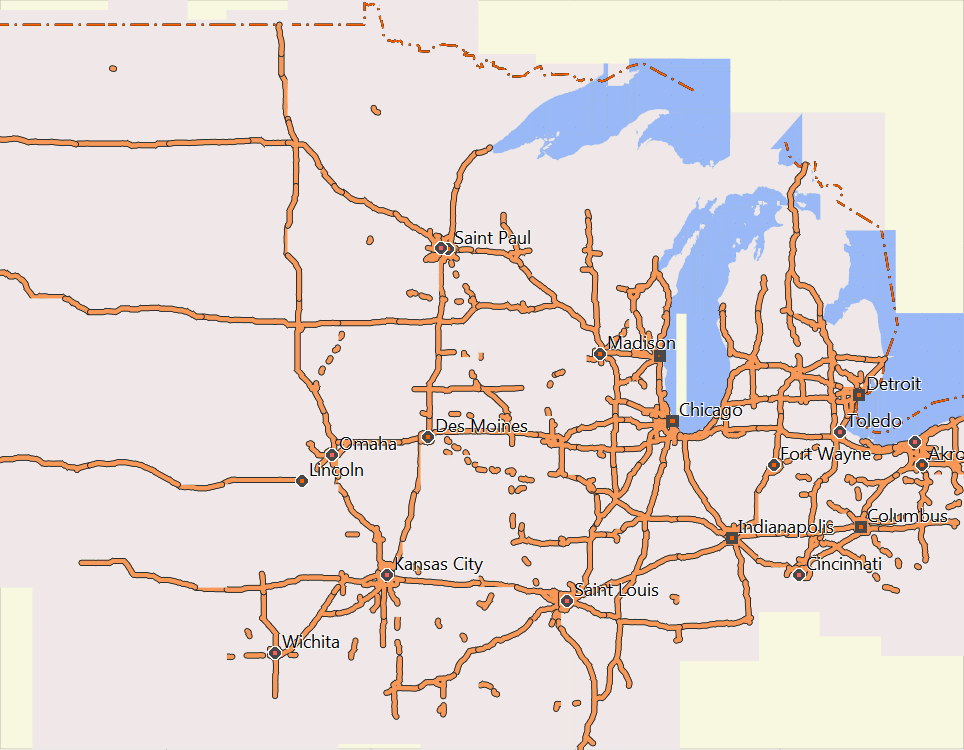
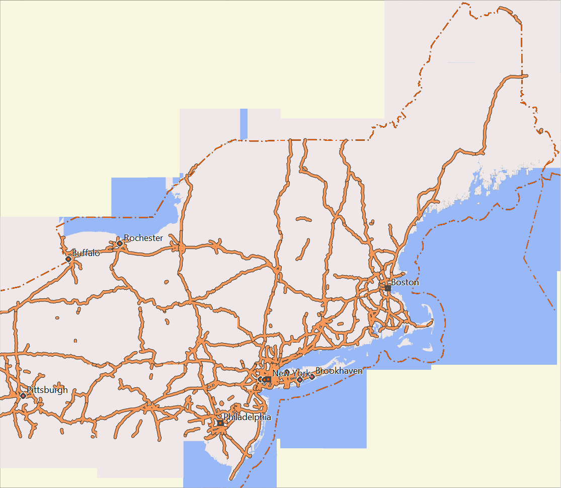
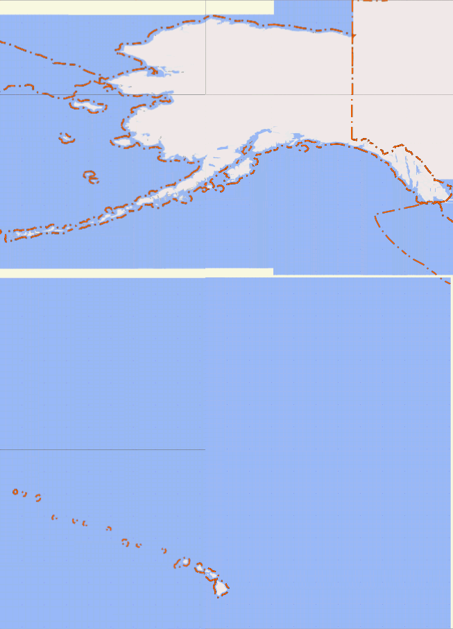
Areas Covered by the US-extracts (screenshots from Mapsource):
US-Midwest
US Northeast
US Pacific
US South

US West
Downloadlinks hier noch einmal:
- Canada
- Please also check out the free "Topo Ibycus" -- probably better than the OpenMTBMap for Canada (based on government data) - https://www.ibycus.com/ibycustopo/
- us-midwest (from North Dakota in the Northwest to Detroit / Akron in the Norteast, to Missouri in the Southeast and Kansas in the Southwest)
- us-northeast (northeast of Pittsburgh and Philadelphia)
- us-pacific (Alaska, Hawai and other Pacific Islands)
- us-south (south of Baltimore, Louisville, Tulsa / Oklahoma City)
- us-west (west of Denver, Colorado Springs, Albuerque -- complete N/S or Canada to Mexiko)
Respektive Premium OpenMTBMap Downloads
- Canada
- us-midwest (from North Dakota in the Northwest to Detroit / Akron in the Norteast, to Missouri in the Southeast and Kansas in the Southwest)
- us-northeast (northeast of Pittsburgh and Philadelphia)
- us-pacific (Alaska, Hawai and other Pacific Islands)
- us-south (south of Baltimore, Louisville, Tulsa / Oklahoma City)
- us-west (west of Denver, Colorado Springs, Albuerque -- complete N/S or Canada to Mexiko)
Und Höhenkonturlinien v2 downloadlinks, müssen für die folgenden Länder einmal separat gedownloaded und entpackt werden - bei Updates kein erneuern nötig):


I use Ride With GPS (RWGPS) to plan my routes, and I use OSM as my base source on RWGPS. Will VeloMaps on my Garmin still work on my routes which I download to my Garmin from RWGPS?
I assume you download tracks not routes – tracks are independant of a map. Routes (autorouting) can only be created with the same map as is on the device.