This post will be extended/updated. First as a short notice - right now the contourlines for the Europe map do not fit the Europe continent maps (of last week 17/18.04) - the new Europe maps which will work with the new contourlines including DEM are compiling right now - but as each version needs about 5-6 hours compilation time, and for both VeloMap and OpenMTBMap there are 4 versions - it will take about 50 hours until they are downloadable! So if you want to install the Europe map with contourlines you will need to wait till the 24/25.04 versions will be online. The country maps are not affected.
First the local language OpenMTBMap europe will be compiled, Then the local Language VeloMap - and last the English language Europe maps.
Furthermore - I will update all contourlines again (subtle improvements in general) - but big improvements in Austria, France, Germany, Italy, Luxembourg, Slovenia, Spain, Switzerland. Now the DEM and contourlines of those countries is based partly (for Germany and Slovenia) - or mainly for Austria, France, Italy, Luxembourg, Spain and Switzerland on LIDAR based altitude data. That means the precision is much much higher - this is mainly true for very rugged areas - as shallow/flat areas are already very good quality. Especially peaks/ridges or canyons are now much better represented and show more accurate height.
First the new contourlines will be shown in the Europe map, and on the next map updates they will also arrive to the country maps.
That also means again that on Thursday/Friday some maps will not fit the newer v4. contourlines.
Some Examples of the better quality:
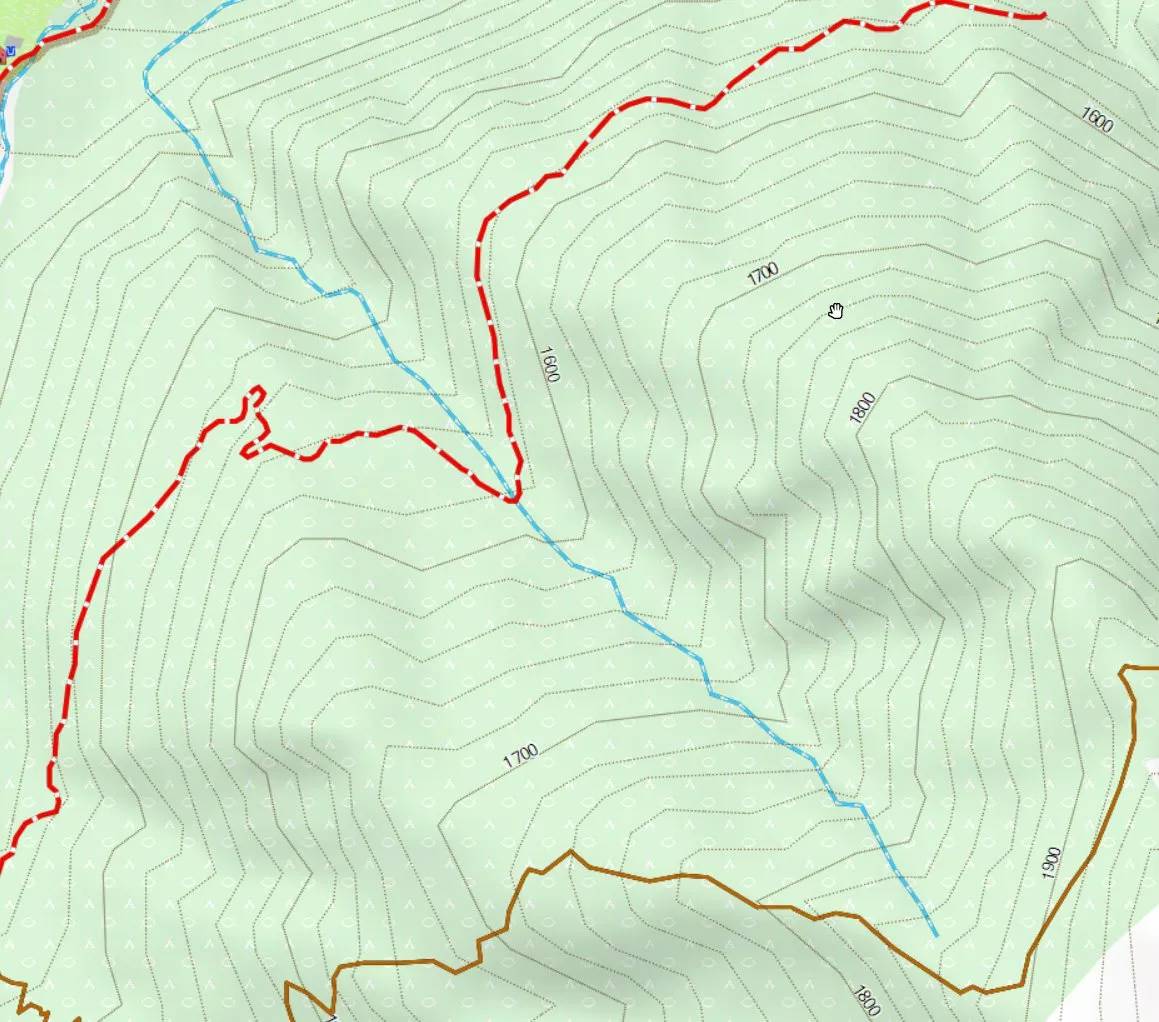
River New:
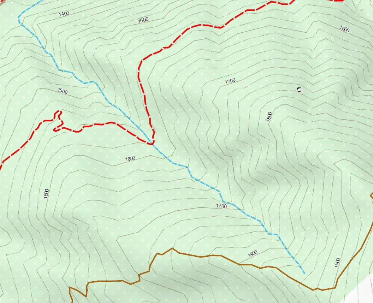
River Old - notice how the river is mal aligned
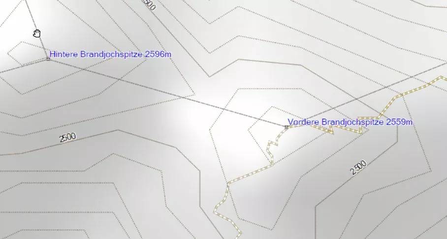
Summit New vs Summit Old - notice that the Vordere Brandjochspitze is much better centered - and the Hintere Brandjochspitze I would guess is badly placed in OSM...


Leave a Reply
You must be logged in to post a comment.