Contents
Support www.VeloMap.org Website and Map development
Please note that I only offer maps of North America to people who have an account on OpenMTBMap. If you have an account please look at the download page while being logged in - then you can see the links and download the maps. Non logged in viewers of openmtbmap/velomap see this page instead.
I spend a lot of time working on the maps, working on this homepage and working on the OSM wiki/forums in order so that everyone can enjoy nice maps for mountainbiking. If you want to support me in doing that, then please donate to motivate me to continue developing.
So if you would like to have maps of North America from OpenMTBMap or VeloMap, please donate to me. www.VeloMap.org/support/membership/
Attention - this page only gives an overview of the Areas covered by the North America downloads - you can download these North America maps (if logged in) from the normal download pages - as listed here: https://www.velomap.org/download/
Areas Covered by the US-extracts (screenshots from Mapsource):
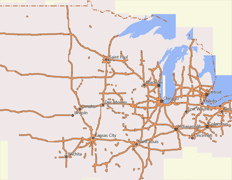
US-Midwest
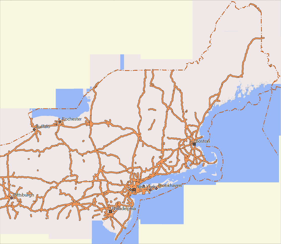
US Northeast
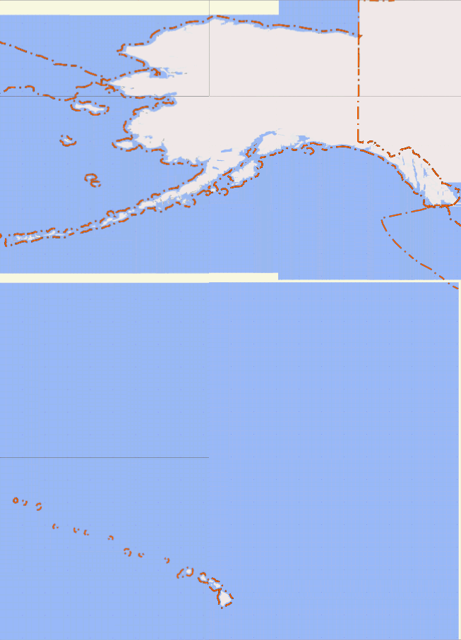
US Pacific
US South

US West
Download links here again for convenience:
- Canada
- Please also check out the free "Topo Ibycus" -- probably better than the OpenMTBMap for Canada (based on government data) - https://www.ibycus.com/ibycustopo/
- us-midwest (from North Dakota in the Northwest to Detroit / Akron in the Norteast, to Missouri in the Southeast and Kansas in the Southwest)
- us-northeast (northeast of Pittsburgh and Philadelphia)
- us-pacific (Alaska, Hawai and other Pacific Islands)
- us-south (south of Baltimore, Louisville, Tulsa / Oklahoma City)
- us-west (west of Denver, Colorado Springs, Albuerque -- complete N/S or Canada to Mexiko)
Respective Premium OpenMTBMap Downloads
- Canada
- us-midwest (from North Dakota in the Northwest to Detroit / Akron in the Norteast, to Missouri in the Southeast and Kansas in the Southwest)
- us-northeast (northeast of Pittsburgh and Philadelphia)
- us-pacific (Alaska, Hawai and other Pacific Islands)
- us-south (south of Baltimore, Louisville, Tulsa / Oklahoma City)
- us-west (west of Denver, Colorado Springs, Albuerque -- complete N/S or Canada to Mexiko)
And Contourlines v2 download links (separate download, needs to be downloaded and extracted once):


I use Ride With GPS (RWGPS) to plan my routes, and I use OSM as my base source on RWGPS. Will VeloMaps on my Garmin still work on my routes which I download to my Garmin from RWGPS?
I assume you download tracks not routes – tracks are independant of a map. Routes (autorouting) can only be created with the same map as is on the device.