Sorry the downloads on this page are only for VeloMap members - get a Membership here https://www.velomap.org/support/membership/ To Try Out you can download the map of Austria (and contourlines) for free! All other maps are only for members.
- OpenMTBMap - Austria - Gmapsupp (MD5)
- VeloMap - Austria - Gmapsupp (MD5)
- Contourlines - Austria - Gmapsupp_20m (MD5)
- Contourlines - Austria - Gmapsupp_10m (MD5)
-
You can also download the Desktop version of most co
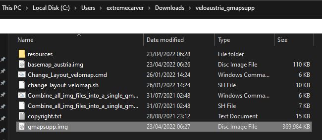
You can also download the Desktop version of most countries for free here: https://www.velomap.org/download/odbl/: For simplicity, I've now also made all countries available as gmapsupp.img download - which after unpacking - you can directly move onto your GPS device. Europe, Africa (OpenMTBMap only so far) and Asia as full continent maps are too big to offer as gmapsupp.img maps - the Europe continent contourlines are available as gmapsupp.img download however. Maps are available Worldwide except for Asia continent map, Africa continent map and Europe continent map - as they are too big. They are usually updated every Friday. Note - this way you lose the possibility to only upload a part of a map to your device as you could do using MapInstall (or Mapsource for Windows users). The advantage is that you can very quickly change the layout (on both Windows, as well as Mac OS x or Linux), and that it's the quickest and easiest way. If you want to use the maps for planning on your desktop - then you will need the Desktop map too or instead. Note: If you plan a route in Basecamp on your desktop - you should use exactly the same map on your device (so same date, same country - but Unicode/Non Unicode does not matter - so you could use Non Unicode map on your GPS device if needed, and Unicode map on your Desktop/Notebook) Video Tutorial - if you prefer watching this as a video instead of reading through the text: All maptiles are compiled with mkgmap using map data from openstreetmap.org & Contributors. You can use and edit the map data by visiting openstreetmap.org. The altitude data for the contourlines is from varying sources in the following priority (if available): more exact info which data is used where - inside the copyright.txt files. Unpack with 7-zip (lzma2) or your preferred unarchiver. E.g use: Highlighted here the gmapsupp.img that you need to move into the Garmin folder (not any subfolder) of your device. If the device accepts mSD cards - always put it onto the SD and not into the internal memory (only for testing if the mSD card has problems use internal) The default layout is "wide" - the layout optimised for most modern garmin GPS units with comparably high DPI. Note the contourlines (altitude height lines) are always a separate second download - so updates are smaller as the contourlines rarely change. The second reason why contourlines are a separate download is that this way you can change contourlines layout independently from the map layout. For the VeloMaps only the buildings are also in a separate gmapsupp.img/download. If you want to move several countries to your device - you will need to rename the gmapsupp.img file. E.g. just call it VeloMap_Austria.img. Make sure not to use Umlauts or custom symbols ("_" is okay, better not use " "space. Latin alphabet only) Make sure that the mSD of your Garmin GPS unit is FAT32 formatted. Else it cannot be read by your device. Second - do not forget that most new Garmin GPS devices cannot read Unicode maps - so in that case for maps that have (Unicode) after the name, resort to the non Unicode maps instead. For very old devices (e.g. Vista HCx) - you can only have a single gmapsupp.img file. Soon I will link here a script for both Linux/OSx and Windows to combine several gmapsupp.img files into a single gmapsupp.img (or include it into the downloads) If you have not used VeloMaps before - please read through the topic about Autorouting: https://www.velomap.org/about-2/autorouting/ Map Legend - look at it too so you can understand the map layout better: https://www.velomap.org/about-2/map-legend/ Unicode is needed to display several alphabets in one map. Non Unicode maps can only display a single alphabet - e.g. kyrillic and latin - but not both. However Garmin blocked using Unicode maps in part of a broken copyright protection on newer GPS device series. Newer Garmin devices cannot use free unicode maps (except if you hack the firmware) - usually a "cannot authenticate maps" message which show on boot. The following Garmin outdoor devices are affected: you will need to download the "Non Unicode" version of the map. Only maps of regions where several different scripts are used - are in unicode. I've listed the non unicode maps however also unter the unicode header for convenience (actually only maps with (unicode ) following their name are actually in unicode. Also english version of maps is only available for countries/regions not using latin only. Garmin Edge x30 or newer Garmin introduced a completely broken high contrast mode - that washes out the colors of the maps. Either disable the high contrast mode on the map visibility section. Or delete the \Garmin\MapThemes\Mountain.kmtf (sometimes also called \Garmin\MapThemes\Mountains.kmtf ) file (back it up if you think you ever want to use that mode. Since the newest firmware in July 2021 you need to enable classic mode - , select a profile, and select . SD Cards This is not about the maps but in general Garmin units that have a microSD card slow only accept SDHC cards - SDXC cards will not work. Max 32GB size and you need to format it with FAT32 (not exFAT). Be careful with 32GB cards which are available as both SDHC and SDXC. 16GB and smaller usually are always SDHC. Default - Local Language Unicode. All labels / street names are exactly like in the name tag of OSM. Note for any country that uses latin - the default will be latin1 and the options below are not available. An exception is the South America continent map that is additionally available in English Non Unicode. For USA/Canada this is also the only option. For European countries using latin if you want the English version - you can use the European continent map that is available in English versions. English Unicode: If available in OSM - English or other European language translation is used. If no translation is available in OSM, the local name tag is used. Local Language Non Unicode: Same as default but instead of Unicode the local codepage is used. So some characters may need to be transcribed automatically in creation. Codepage is always the local default codepage. English Language Non Unicode (always latin1): If available English or other European language translation from OSM is used. If not names are transcribed to Latin. It's very easy to chose a Map layout: By default I've disabled that maps are loaded for display/to show in Basecamp. However if you like to see the map when connecting the GPS device or mSD card to your computer with Basecamp open - you can run the change map layout script (see Adapting the Map Layout above) - at the end of the script you will be asked to enable or disable the Basecamp Map Visibility. The following contourlines are with the standard recommended equidistance of 20m. In mountaineous regions I recommend to use 20m equidistance. However as of popular demand you can alternatively download 10m equidistance for all countries and continents (except Asia continent map - because it is too large). Note that the underlying data outside of Europe in mountaineous regions is actually not good enough to really profit from 10m equidistance lines at all. For flat regions however worldwide 10m contourlines can make sense. So that's why I offer them for download worldwide. In general I recommend not to install more than 6-8GB of maps on your device at any time. As the contourlines do not have an address index or any POI they don't count towards that limit - as they will not slow down your device like normal maps do. Do note however that all Garmin devices have a max tile limit of 2048 or 4096 - so do not forget about that. The South America contourlines 10m for example already have about 3000 tiles. So better just export those ones that you need by using the windows or osX gmapi download instead and send with MapInstall. (that is alsow why there are not Asia gmapsupp 10m contourlines - they would break the 4096 tile limit.) If you break the 2048 or 4096 tile limit - some tiles simply will not be shown - which ones I cannot tell you - that's random. Be very careful about this limit if you go for the 10m contourlines for a continent - or if you insist to install the 20m Asia continent gmapsupp contourlines (also over 3000 tiles). I cannot tell you for gmapsupp.img downloads consisting of several gmapsupp.img maps which map covers which part. That is a bit random too. You can look at the gmapsupp.img map coverage by loading them in QmapShack. Continents Contourlines 20m: German Bundeslaender 20m: France DOM-TOM 20m: For an Overview of the areas covered by the US-extracts please visit: www.VeloMap.org/support/north-america/ The following contourlines are with equidistance of 10m. In mountaineous regions I recommend to use 20m equidistance instead. However as of popular demand you can alternatively download 10m equidistance for all countries and continents (except Asia continent map - because it is too large). Note that the underlying data outside of Europe in mountaineous regions is actually not good enough to really profit from 10m equidistance lines at all. For flat regions however worldwide 10m contourlines can make sense. So that's why I offer them for download worldwide. Also in Europe only where there is LIDAR coverage 10m contourlines make sense in mountain regions. Inside the copyright file you can find out the data sources. In general I recommend not to install more than 6-8GB of maps on your device at any time. As the contourlines do not have an address index or any POI they don't count towards that limit - as they will not slow down your device like normal maps do. Do note however that all Garmin devices have a max tile limit of 2048 or 4096 - so do not forget about that. The South America contourlines 10m for example already have about 3000 tiles. So better just export those ones that you need by using the windows or osX gmapi download instead and send with MapInstall. (that is alsow why there are not Asia gmapsupp 10m contourlines - they would break the 4096 tile limit.) If you break the 2048 or 4096 tile limit - some tiles simply will not be shown - which ones I cannot tell you - that's random. Be very careful about this limit if you go for the 10m contourlines for a continent - or if you insist to install the 20m Asia continent gmapsupp contourlines (also over 3000 tiles). I cannot tell you for gmapsupp.img downloads consisting of several gmapsupp.img maps which map covers which part. That is a bit random too. You can look at the gmapsupp.img map coverage by loading them in QmapShack. German Bundeslaender 10m: France DOM-TOM 10m: For an Overview of the areas covered by the US-extracts please visit: www.VeloMap.org/support/north-america/ Many people prefer to not see buildings using the VeloMap in cities. Sadly I cannot filter buildings based on if they are on the countryside or in a city. If you are not interested in the buildings - removing them makes the map faster to pan around - and will save a little bit of battery (the speed difference will be big on older Garmin GPS devices - but nearly not noticeable on newer Garmin GPS devices. Besides of course if you are not interested in the buildings - not seeing them helps with contrast and you can focus on the streets/ways. Other people prefer to see the buildings. For Right now I only move the buildings to a separate layer for the VeloMap - for off road use/ Mountainbiking in general I think that buildings should be shown. I may create that additional layer in future for OpenMTBMap too if there is demand. Just as above for the contourlines - copy the gmapsupp.img file into the Garmin folder on your GPS devices mSD card (or internal memory if your device has no mSD card). In general I recommend not to install more than 6-8GB of maps on your device at any time. As the buildings do not have an address index or any POI they don't count towards that limit - as they will not slow down your device like normal maps do. Do note however that all Garmin devices have a max tile limit of 2048 or 4096, or around 15000 tiles - so do not forget about that. If you break the 2048 or 4096 tile limit - some tiles simply will not be shown - which ones I cannot tell you - that's random. Be very careful about this limit if you go for continent gmapsupp.img downloads of Europe or Asia. Asia is only possible with contourlines and buildings on devices with 15.000 tiles limit. Europe likely soon break the 4096 tile limit. Why should you download the gmapsupp.img format maps?
- Map Data
Contourlines/DEM data:
Installation:
Compatibility - Unicode vs Non Unicode (cannot authenticate maps)
Language and Codepage
Adapting The Map Layout
Map Visibility in Basecamp
Joining gmapsupp.img files for very old devices
Europe Contourlines 20m:
Africa Contourlines 20m:
Asia Contourlines 20m:
Australia-Oceania Contourlines 20m
North America Contourlines 20m:
South America Contourlines 20m:
Continents Contourlines 10m:
Europe Contourlines 10m:
Africa Contourlines 10m:
Asia Contourlines 10m:
Australia-Oceania Contourlines 10m
North America Contourlines 10m:
South America Contourlines 10m:


Hi, Is it possible to add Costa Rica to your available country maps ? Thank you.
No, but the central America continent map is actually pretty small. So just use that one instead.
Eine Frage: stimmt es generell, dass man die Kartendaten im Speicher möglichst klein halten soll? Bei der Suche nach Strassen leutet mir das ja ein, aber auch bei der Routenberechnung oder beim Bewegen der Karte auf dem Screen.
Ich GPSMAP66s, das ich vor allem in der Grosstadt benutze, und da kann die Berechnung von nur 10km richtig lange dauern…
Pardon die vielen Tippfehler – vor allem gehört hinter das Wort “Screen” ein Fragezeichen.
Möglichst klein nicht, 4-6GB an Karten sind kein Problem. Aber 15-20GB an karten würde ich sein lassen. Bootzeit bzw Suchfunktion von POI wird vor allem beeinflusst. Die Routenberechnung hat damit nicht zu tun. Da kann man nur bei den Optionen ändern (kurze Route rechnet schneller als beste Route).
Moin,
woran sehe ich bzw. wie erfahre ich, wenn es ein Kartenupdate gegeben hat?
Klicke auf den MD5 Link hinter jedem Download für das letzte Update Datum.
Hello. I was wondering if it is possible to create a map of ONLY the Balearic-Islands (aka mainly Mallorca) ?
I was hoping to create a tiny map which uses very little space for older GPS devices.
Thanks
You can do so with MapInstall sending just those tiles.
Über viele Jahre habe ich hier gute Karte für unsere Touren bekommen. Jetzt habe ich alle möglichen Varianten ausprobiert, eine gmapsupp aufs etrex 30x zu bekommen und bin gescheitert. Ich verabschiede mich hier und werde den Garmin Dreck in den Müll schmeißen.
Ich weiß nicht was dein Problem ist – wenn du schreibst was du machst und wo du stecken bleibst kann ich idr sicher helfen. Evtl hast du eine Unicode Karte gesendet – du musst am etrex 30x die non unicode versionen wählen wenn nicht lateinische Schrift im Land.
Hallo Felix,
ich hab leider das selbe Problem. Habe die non-Unicode VeloMap Germany gerade heruntergeladen und auf das etrex 30x kopiert; sonst ist nichts auf der SD-Karte drauf. Das etrex bootet bis “loading profiles” und geht dann aus.
Nimm die Sd Karte heraus, und formatiere sei neu. Stelle sicher dass du die VeloMap Germany nicht evtl noch als ältere Version auf dem internen Speicher hast. Bzw deaktviere mal alle Karten am internen Speicher durch umbennen von *.img auf *.img.bak (wenn das hilft dann aktiviere sie eine nach der anderen und teile mir mit welche das Problem ist).
SD-Karte neu formatiert, Verzeichnis “Garmin” erstellt, nur die gmapsupp.img reinkopiert. Im internen Speicher sind überhaupt keine .img-Dateien. Wenn es ohne SD-Karte bootet, ist da noch eine “digital globe” map, ich weiß aber nicht, welche Datei das ist. Ist auf “disabled” gestellt. Geht immer noch aus beim Booten.
mtbmap dasselbe.
bitte deaktivere mal alle .img Karten auf der SD und im internen Speicher per .img.bak – dann eine einzige Karte aktiviereen.
Weiterer Versuch – verschiebe (nicht kopieren!!!!) eine Karte vom internen Speicher auf die SD Karte un schau was passieret. Ich vermute deine SD Karte ist kaputt.
Habe jetzt die SD-Karte ausgetauscht – daran lag es auch nicht. Andere Karten sind keine da, siehe oben.
(Ich habe zum Glück noch ein Backup mit einer etwas älteren VeloMap….)
bitte mache mal Screenshots vom garmin Verzeichnis sowohl interner Speicher als auch Sd Karte und hänge sie hier an oder antworte mir damit per email!
Weiterer Test: Habe jetzt mal nur Niedersachsen drin. Damit bootet das etrex fertig, ich scrolle nach Niedersachsen, die Karte fängt an, sich aufzubauen, etrex geht aus.
Ich habe noch nie von solchen Problemen gehört. Bin da etwas ratlos. Vor allem wüsste ich nicht wieso alte Karten laufen die neuen aber nicht.
Hab eine GPSMAP66s, die in letzter Zeit auch hin und wieder einfach ausgeht. Ich bekomme seit meinem letzten Update der Velopmap Deutschland auch immer wieder Routenberechnungsfehler. Könnte allerdings auch sein, dass es zwischenzeitlich ein Firmwareupdate bei der GPSMAP gab. Ich werde jetzt mal die SD formatieren und die Daten neu runterladen und aufspielen. Mal sehen, ob das was bringt.
Bei Peter hat ein Hard Reset vom extrex 30x wenn ich mich richtig erinnere zur Lösung geführt. SD formatieren/Daten neu runterladen ist eher nicht nötig – aber mal alle Tracks/Routen/Logs entfernen könnte auch eine Lösung sein. Es müssen nicht die Karten sein die dazu führen.
Ich habe gerade eben die SD formatiert und wollte das Kartenmaterial am Rechner aufspielen. Dabei kam es immer wieder zu den gleichen Fehlermeldungen “disk disappeared” oder so ähnlich. Das kann an Kabeln oder Adaptern liegen, aber auch an der SD. Ich mach das ganze jetzt mal “durch” die GPSMAP. Dauert ewig, aber wenn ich da ähnliche Fehler bekomme, kauf ich mal eine neue SD. Alte Daten runterschmeissen schadet auch nichts…
SD Karte könnte korrupt sein – aber Hard Reset hat nix mit der SD zu tun. Probiere den auch einmal (dann ist dein Gerät komplett ohne Einstellungen, Routen/Tracks usw – karten werden dabei von der SD nicht gelöscht). Aber ja mSD Karten sind wenig Dauerstabil OHNE Nutzung. Wenn das Gerät 1 Jahr ausgeschaltet war kann es nötig sein eine SD neu zu formatieren. Es gibt auch Analyse Tools für SD Karten.
Hi Felix, I’ve downloaded the non unicode VeloMap Morocco map and end up opening Mapsource. The map is listed in Mapsource (top left) but I can’t get it to display. Another option I tried was to download it to a folder and press enter. I ended up in Basecamp and there are no further options.
I guess there is more to overcome when contour lines are downloaded required.
Help!
My Garmmin is an etrex 30x
I don’t fully understand what you did and what not. Best uninstall the map again. Then when reinstalling make sure that if you tick one of the contourlines options – you also download the contourlines (same folder as the map download) and provide them to the installer. I’m pretty sure you did something wrong there. Or are you trying to display gmapsupp.img downloads? They are NOT meant for display on PC but only on device. move the “gmapsupp.img” file into the /garmin folder on the SD card.
Hi, I am slightly confused as the advantage of the gmasupp.img file is that it can be downloaded directly onto the SD card for the Garmin device. However, it can only be downloaded as a zip file so you have to have a computer to do this. Is there a way of downloading gmasupp.img files directly rather than going through the extraction process?
No – but nearly all Garmin devices cannot download directly from internet anyhow. It saves you the time installing / sending with MapInstall vs just extracting (wich is very fast due to lzma2).
If you do want to combine the .img files I get similar problems with
“Combine_all_img_files_into_a_single_gmapsupp_img.cmd”
Rger Hill
Whoops, mixing up two actions.
The most important thing was to change the layout of the map to, e.g. something like “9: Topo — Classical topographic map…”
The Change_Layout_velomap.cmd gives the errors shown. I cannot change the layout to something more suitable for me
I am not sure why this error happens – it should not happen. Open the bat file with an editor and remove all “echo off” lines – then tell me the first line with an error. I guess you miss something.
Did you start the .bat with double click or did you drag (several?) files onto it. You can only drag a single gmapsupp.img file onto the change_layout .bat (or several for the combine scripts).
attachment 4
attachment 3
Sorry joining is done with the combine script shown here.
attachment 2
How do I Look at even the gmapsupp.img I get after extracting the .7z file.
I would also like to include the contours and buildings layers that I downloaded from the Premium Maps page. I assumed that this would be done by using the Change_Layout_velomap.CMD file, but it doesn’t work.
When I run it I get
see Change_Layout_velomap 1.jpg,
then Change_Layout_velomap 2.jpg,
then Change_Layout_velomap, files in top directory.jpg,
then Change_Layout_velomap, files in resources directory.jpg.
The path is E:\Users\Roger\Pictures\Maps\Garmin\premium img files\Extracted
Why do you want to join them? Joining is done with the join gmapsupp script, but only needed for very old devices – pre 2009 or so.
Gmapsupp are not for looking on pc (it’s possible but slow – transfer them to sd card of your Garmin device – then Basecamp will show them). For pc use the pc/os X maps instead.
Hallo, ich habe da ein Problem. Bin gerade in Schweden und stelle fest dass ich auf dem Garmin Oregon 600 bei Routen oder Ziel-Navigation kein zu erwartendes Höhenprofil angezeigt bekomme. Da ist nur ein grauer Balken.
Ich habe die Karten direkt für Garmin GPS-Geräte heruntergeladen, mit Höhenlinien und den Höhenschattierungen für Europa. Was für einen Fehler habe ich denn da gemacht???
Gruß, Fritz
Hallo Fritz, die Höhenschattierungen für Europa – die DEM Overview Map ist diesbezüglich irrelevant. Du solltest immer die Höhenlinien nehmen welche zur Karte an sich gehören – wobei die komplette Europa Höhenliniendatei eigentlich auch gehen sollte – aber evtl ins Kachellimit des 600er gerannt – genau daher empfehle ich ja nur 5-8GB an Karten insgesamt. Die Europa Höhenlinien sind aber gut 4GB alleine. Sende lieber mal nur die Schwedenkarte mit den Schweden Höhenlinien statt ganz Europa.
Hi an Alle. Kann leider die Karten – Velo/Mtb – auf das Edge1030Plus nicht installieren. Alles ist den Ordner kopiert, aber nirgendwo sichtbar…
Wie kann man an die Karten im Gerät kommen?
bitte um screenshot des Garmin Ordners. Bzw ich nehme an du hast die Karten nicht entpackt / korrekt platziert. Lies bitte die Anleitung. Im Karten Setup Menü sollten sie aktivierbar sein.
Hallo,
ich bin Premium Mitglied.
seit längerem möchte ich heute mal wieder die Europa Velo Map Karte auf meinem Desktop intallieren, da ich einen neuen Windows Surface Tablet habe.
Sehe ich das richtig, dass man die komplette Europa Karte nicht mehr downloaden kann, da sie anscheinend zu groß ist?
Ich möchte die karte nicht direkt auf dem GPS Gerät installieren, sondern auf dem Windows Surface Go 3, um Routen und Tracks zu erstellen und nur die #Tracks auf das GPS übertragen.
Irgendwie verzweilfle ich da gerade.
wenn ich die Datei: Installer VeloMap Europe odbl.exe (MD5) (Unicode)” Downloade und dann ausführe, bricht die Installation ab, weil er die ZIP Datei nicht findet. Aber wo kann ich die komplette Europa Kate als ZIP Dateiherunterladen? Oder bin ich irgendwie zu doof dazu?
Danke schon mal
Die .7z Datei ist jeweils hinter/unter dem Installer verlinkt. Du brauchst die exakt zum installer passende (gibt ja 4 Versionen Sprache/Unicode).
Hallo @ extremecarver
vielen Dank, scheinbar hatte ich Tomaten auf den Augen? 🙂
Jetzt hab ichs auch gefunden, funktioniert alles.
Danke!
HI, UNABLE TO FIND SINGAPORE MAP
found this : https://www.velomap.org/?s2member_file_download=odbl/mtbmalaysia-singapore-brunei_gmapsupp.7z
was looking for it in VeloMap
that is normally linked:
https://www.velomap.org/?s2member_file_download=odbl/velomalaysia-singapore-brunei_gmapsupp.7z
(there is no English version – as all countries use Latin script by default).
Hallo,
ich habe eine Frage zum Kartenlayout. Ich habe die Gmapsupp.img für Belgien auf mein Garmin Edge 810 übertragen. Die Karte zeigt sehr viele Details (z.B. Geschäfte) die beim rauszoomen die Straßen überlagern und daher die Navigation stören. Wie kann ich denn die Details auf die Straßen reduzieren? Ich habe schon versucht das Raceprofil zu aktiviere und auf die Veränderte Gmapsupp.img aufzuspielen. Ich habe aber damit das gleiche Ergebnis.
Vielen Dank und herzliche Grüße
Declutter aktivieren, und evtl Details auf niedrig. Ich glaube du hast die Details zu hoch eingestellt – normalerweise sind die POI eher kaum zu sehen außer sehr nah reingezoomt.
Danke, ja da war das Problem. Konnte alles im Menü meines Garmin einstellen. Sieht jetzt super aus
Hallo Felix,
ich wollte seit längerem mal wieder eine VeloMap (Sweden) mit den Höhenlinien runterladen. Dabei kamen die in der Anlage (Bildschirmscreens) aufgeführten Meldungen. Ich habe zwischenzeitlich die Installation auf meinem Laptop (Windows 10) und auf mein Garmin etrex 30x hinbekommen, aber leider o h n e die Höhenlinien. Ich versuchte es dann damit, dass ich die VeloMap ohne Konturlinien runtergeladen habe und die Konturlinien sollten in einem 2. Schritt installiert werden, was aber nicht funktioniert hatte.
Noch im letzten Jahr konnte ich eine entsprechende Länderkarte mit einem Klick erfolgreich inkl. Höhenlinien laden.
Kannst du mir da bitte weiterhelfen, wie ich die Höhenlinien auf die Schwedenkarte bekomme? Das gleiche gilt auch für die MTB-map.
Schon jetzt vielen Dank für Deine Hilfe!
Gruß Michael
Separater Download, siehe Tutorial.
du musst einfach vom Contourlines 20m Tab die Schweden Höhenlinien runterladen – und dann auswählen.
In der China Hoehenliniendatei ist keine .img . Ist das korrekt so, wenn ja welche der Dateien muss ich auf meinen Germin kopieren?
Danke für den Hinweis – du bist der erste dem es aufgefallen ist. Ich habe es gerade korrigiert (muss die gmapuspp.img in dem Fall händisch per MapInstall erzeugen – da >4GB, und hatte dies für China vergessen). War also schon fast ein halbes Jahr lang kaputt.
Vielen Dank für die Karten und die Arbeit die dahinter steckt.
Ich habe gerade die Höhenkonturlinien ausprobiert (Europa, 20m). Diese werden auf dem Gerät in schwarz angezeigt. In der Garmin Topo Germany v9 sind Feldwege schwarz und die Höhenlinien in einem leichten braun. Beim Kartenwechsel ist das für mich sehr irritierend beim Ablesen.
Gibt es eine Möglichkeit, dass die Höhenkonturlinien ähnlich dezent wie in der Garmin Topo angezeigt werden? Zumindest bei den bestehenden TYP-files konnte ich dazu keine offensichtliche Möglichkeit finden.
Bei den gmapsupp konturlinien ist ein batch/bash File dabei mit dem du mehrere Optionen für das aussehen der Höhenlinien hast. Du musst dann die Karte ohne Höhenlinien sende.
Aaaaah, mein Denkfehler. Ich dachte “Default” meint hier das default TYP-file, das beim Download bereits inkludiert ist.
Danke!
Nein – Default = was dein Gerät als Default hat. Ich habe die Höhenlinien schwarz statt braun damit es keine Verwechslungen zu Wanderwegen gibt. Schwarz/grau Straßen sind immer etwas dicker…
Hallo, ich hätte da noch eine Frage. Über die Funktion “Find” am GPSmaps kann ich verschiedene Städte suchen. Das funktioniert bei einigen Städten in der VeloMap für Chile in der Version direkt fürs GPS-Gerät sehr gut. Andere auch große Städten, wie zB Santiago oder San Pedro de Atacama, sind nicht gelistet und werden auch nicht gefunden. Bei der gmapsupp.img für Bolivien werden gar keine Städte gefunden. Ist es einfach so, dass diese Karten nicht alle Städte listen, oder könnte ein Fehler meinerseits vorliegen? Mit freundlichen Grüßen!
Du kannst Städte nur in einem gewissen Umkreis der aktuellen Position finden. Setz dein GPS Signal im Demomodus nach Peru oder Chile – und es wird gehen. Nur Adressen lassen sich überall suchen.
Hallo,
erst möchte ich mich bedanken, dass es diese Seite und die vielen Karten überhaupt gibt.
Ich habe seit gestern eine Mitgliedschaft, bezweifle aber, dass ich hier richtig bin. Mir ist das alles etwas zu schwierig und versteh in den Kommentaren auch nur Bahnhof. Ich benutze ein GPSmaps 66s. Darin habe ich eine mSD-Karte mit 32 GB und der Formatierung FAT32. Auf dieser SD-Karte läuft bereits die Freizeitkarte Österreich reibungslos.
Nun habe ich versucht die Chilekarte direkt auf die SD-Karte zu spielen. Ich habe die velochile_gmapsupp und die contours_chile_gmapsupp heruntergeladen und entpackt. Durch das entpacken sind zwei Ordner mit den selben Namen entstanden. Diese beiden Ordner habe ich samt kompletten Inhalt auf die SD-Karte in den Ordner Garmin gespielt. Ich habe nichts aus den Ordnern entfernt oder ausgesucht. Sie einfach nur auf die SD-Karte gespeilt. Nun kann ich die Karten im GPS-Gerät nicht darstellen. Ich kann sie unter dem Menüpunkt “Karte konfogurieren” auch nicht aktivieren.
Wenn ich das GPS-Gerät an den Computer anschließe und Basecamp öffne, so zeigt mir Basecamp im Verzeichnis der SD-Karte an, dass ich Chilekarten oben hab. Es zeigt mir 3 Karten an: velo_cl-5.12.2020 – Die Karte stellt mir im Basecamp die Straßen und Landschaften ohne Höhenschichtslinien dar. Dann mtb_cl_cntrs_15.5.2020 – zeigt nur Höhenschichtslinien und die Übersichtskarte mit nur rudimentären Karteninhalten: chile_5.12.2020_velo
Was kannst Du mir raten, damit ich die Karten benutzen kann? Mir ist v.a. wichtig, die Karte am GPS-Gerät zu nutzen und nicht im Basecamp.
Schöne Grüße und Danke!
Du hättest die Anleitung auf der Download Seite lesen sollen. Du darfst nur die gmapsupp.img aufs GPS Gerät kopieren, plus die .IMG der Höhenlinien. Nie den ganzen Ordner, der wird ignoriert…
Herzlichen Dank! Es funktioniert. Sehr viele Details im städtischen Bereich in der Karte.
Angenommen, meine Reise geht durch 4 Länder, die jeweils mit einer gmapsupp.img kommen. Muss ich dann 4 microSD Karten anlegen, oder kann ich die Dateien auch umbenennen?
Steht ja in der Anleitung – auf den meisten GPS Geräten von Garmin kein Problem – nur bei sehr alten nicht möglich (bzw bei Smartwatches evtl auch nicht). Aber du musst dann an der Grenze die Karten aktivieren/deaktivieren. Besser ist für den Fall also einen Ausschnitt aus der Europakarte nehmen. Ansonsten ist einseitig von der Grenze die Karte mit leerem Inhalt/weiß überdeckt.
Danke für den Hinweis. Das hab ich gemacht – alles umbenannt und einzeln rüberkopiert. Funktioniert auch. Ich kann die Karten auch aktivieren, alles super. Bis auf die Karte von Frankreich. Die habe ich gleich zweimal kopiert und wieder gelöscht, und dann mit mapinstall rübergeschoben. Aber sie will einfach nicht in der Liste zum Aktivieren der Karten in der GPSMAP66s erscheinen.
Was auch erscheint ist eine germany_16.07.2021.velo Datei, allerdings keine vergleichbaren .velo Dateien für die anderen Karten
Was mache ich falsch?
Gibt es vielleicht eine Obergrenze an Karten, die man auf eine microSD Karte schieben bzw. in der GPSMAP66s gleichzeitig vorhalten kann?
Oder hast Du sonst eine Idee?
Vielen Dank!
PS:
Zum Kontext: Ich bereite eine Radreise durch Deutschland, Schweiz, Frankreich, Spanien und Portugal vor. Alle Karten bis auf Frankreich konnte ich auf der gleichen 32GB mSD Karte installieren. Bis auf die Frankreich Karte. Desweiteren ist auf der Karte noch eine OFM_Alps Karte.
Entferne die OFM_Alps – ich nehme an die hat dieselbe FID. Mit den Karten die du zuerzeit hast solltest du nicht beim Limit von 4048 Kacheln angekommen sein. Besser als alle Länder separat – exportiere/sende den Ausschnitt den du brauchst mit MapInstall aus der Europakarte.
Danke für die prompte Antwort. Hab ich gemacht, Frankreich taucht trotzdem nicht auf. Ich hab noch ein paar mSDs hier rumliegen.
Wenn auch nicht unbedingt die elegantere Lösung, ist es für mich momentan wschl. einfacher die Daten dann auf mehrere Karten zu verteilen. Wenn ich dann von der Tour zurück bin (bin etwas unter Zeitdruck) werde ich mich an das Kachelthema heranwagen.
Mit entfernen ist nicht deaktivieren gemeneint – sondern wirklich löschen oder Dateiendung von .img nach .img.bak umbenennen. Es gibt keinen anderen Grund warum die Karte nicht da sein sollte (also nicht im Karten Setup Menu auftaucht). Es könnte noch sein dass du nur im Grenzbereich geschaut hast – und sie dort eninfach überlappt ist mit weißem Inhalt. Genau daher ja die Europakarte.
Ja klar. Gelöscht, wieder aufgespielt. Zwei Mal direkt, einmal via mapinstall, dann ofm alps gelöscht, dennoch erscheint sie nicht im Setup Menu. Siehe dazu screenshot, da war eins der beiden France Files wieder am laden.
Ich hab jetzt eine zweite SD Karte am Start und installiere brav via Mapinstall/Mac, was leider ewig dauert. Melde mich später mit dem Resultat.
Die Basemap brauchst du nicht! Entferne die – du hast ja wahrscheinlich am internen Speicher eine Basemap. Ich rag mich allerdings was das Symbol hinter france_gmapsupp.img bedeutet – evtl nicht fertig übertragen? Das ist etwas komisch… Schau auch was an Karten im internen Speicher am 66 im Garmin Verzeichnis liegt.
Auf der zweiten SD Card hat es geklappt.
Respekt, die Karten sehen auf den ersten Blick wirklich gut aus.
Das ist sehr komisch – eientlich hättest du noch an kein Limit kommen dürfen. Ich vermute du hast einfach nur die weiße Karte gesehen – oder falsch hineingezoomt – Das waren eindeutig noch nicht zuviele .img Karten. Du soltest halt wegen dem Überallpungsproblem nur eine Karte aktivieren – sonst ist auf einer Seite der Grenze immer weiß obwohl die Karte aktiv ist. Bzw es hatte irgendwas mit dem Übertragen – dieses runde Symbol auf deinem Screnshot ist nicht normal (könnte auch sein dass die mSD Karte kaputt ist).
Nee, Frankreich war auf der ersten mSD im Karten-Setup garnicht aktivierbar. Was Du weiter oben gesehen hattest war lediglich eine Symbol, dass ich die Karte (einmal mehr) installiert hatte, während ich den Screeenshot gemacht hatte.
Und es irgendwas ist immernoch seltsam, auch mit der zweiten mSD: Ich kann die Frankreich-Karte nun im GPSMAP aktivieren & sehen, aber sie taucht nicht in Basecamp auf, wenn ich das GPSMAP anschliesse.
Im Screenshot links eine Liste von 4 Karten, die Basecamp im GPSMAP findet, rechts der MacOS Finder, der mir anzeigt, dass auf der mSD 5 Karte sind. Links fehlt die Karte von Frankreich.
Du hast die Frankreich Karte wahrscheinlich mit MapInstall gesendet – mit MapInstall gesendete Karten tauchen nicht in Basecamp auf – da ich annehme dass sie dort ja schon installiert sind. Warum die Frankreich Karte auf der ersten mSD nicht funktioniert hat – erklärt dies nicht. Ich vermute eine gefälschte / kaputte mSD wenn auf der anderen jetzt alles geht.
Für basecamp besser die PC/Mac Version herunterladen und installieren..
Meine Frage geht in diesselbe Richtung, nur den Zuschnitt bräuchte ich etwas anders: DACH+Fra würde bei mir fast alles abdecken. Falls BeNeLux noch reinpasst auch gut.
Wenn du mehrere Regionen machst, wäre es gut, wenn sich diese überlappen, d.h. entweder ganze Länder in mehreren Regionen enthalten oder ein Überlappungs-Streifen von z.B. 100 km.
Ist die Alps nicht schon sowas in diese Richtung?
Michael
Ich biete Alps an – weil dies viele betrifft. Für andere Regionen musst du dir selber per MapInstall aus der Europakarte den Ausschnitt erstellen.