Note for Premium Members:
Your account does not allow you to login into OpenMTBMap website - However you can download all Openmtmbaps from here for Windows users: https://www.velomap.org/download/openmtbmap/
Mac OSx user - just scroll down here on the normal macosx download page: https://www.velomap.org/de/download/macosx/
Gmapsupp.img Downloads are here: https://www.velomap.org/download/premium-gmapsupp-img-directly-for-garmin-gps-units/
OpenMTBMap.org is the Project where it all started...
In April 2009 I started OpenMTBMap.org. For the first time, there was a wide-scale availability of maps for Mountainbikers. Since then mountainbike related information in Openstreetmap has increassed tremendously (from being virtually non-existant before). One year later more than 30.000 ways in Europe alone are classified by mountainbikers for mountainbikers. One can find information about the difficulty of biking up or down a way, autorouting sends you downhill on more difficult ways then uphil......)
OpenMTBMap.org is the best map for mountainbikers and hikers to find their way.
Please visit https://openmtbmap.org to find out more...
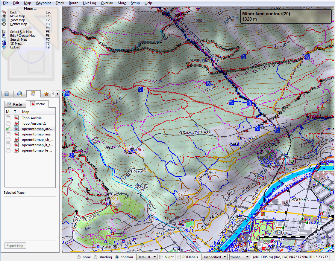
- 6 Different layouts: Five high contrast layouts optimized for the different Garmin GPS (.e.g different layout for hiking than for mtbiking or for cycling). One layout for Desktop use. See the Map legend or screenshots (desktop) or screenshots (GPS)
- Type of Way/Street? Clear differentiation between all street types. The maps display info out of the eyes of a biker / hiker. E.g. downhill arrows for steep singletracks
- MTB & Hiking & Cycle relevant information like drinking water, alpine huts, guideposts,... Routes shown prominently besides (not instead of) the streets differentiated by colour for type and based on importance
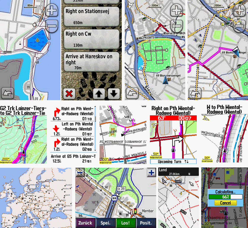
- Navigation - Advanced autorouting for mtbikers, cyclists and hikers. You can plan your routes and tracks on your desktop using the same maps as on your GPS. All maps come with Address search
- Easy installation in Garmin Mapsource, Garmin Basecamp or Qlandkarte GT to plan your tours and tracks on your desktop.
- Contourlines integrated nearly worldwide based on the excellent viewfinderpanoramas.org data. Much higher quality in mountainous regions than the generally used void filled SRTM3".
- Participate? Map Incomplete or wrong? You can participate and add missing to OSM. I update the maps weekly, so every week the maps become better and more complete! Join over 300.000 mappers worldwide to add ways or fix data yourself.
- Good Documentation because everything you want and need to know for using the maps is found on OpenMTBMap.org. Get Started and download the maps


Korrektur: Nur ich kann mich mit meinem account auf OpenMTBMap.org nicht ein-loggen. Was mache ich falsch?
Hab es schon gefunde. gibt es ja unter VeloMap. Danke!
du hast es ja gefunden, die Karten sind immer ident und zeitgleich aktualisiert – aber die Datenbank der Website unterschiedlich. Daher kannst du dich nur hier einloggen.
Ich glaubte, ich könnte mit mainem VeloMap account auch openmtmap-karten herunterladen. Habe das schon einmal gemacht. Nur ich kann mich mit keinem account auf OpenMTBMap.org nicht ein-loggen. Was mache ich falsch?